Dubai Water Canal Area Guide 2026: Bridges, Boardwalk, Boat Rides & What to See
The Dubai Water Canal is a 3.2-kilometer engineered waterway that extends Dubai Creek through Business Bay, Al Safa, and Jumeirah out to the Arabian Gulf. Opened in 2016, it links Downtown Dubai to the coast with 12 km of walking and cycling paths, five pedestrian bridges, a sensor-triggered waterfall beneath Sheikh Zayed Road, and dozens of waterfront cafes, restaurants, and boat tour operators.
Few places capture how quickly Dubai reshapes its own geography like the Dubai Water Canal. A decade ago, this stretch of the city was landlocked. Today, it’s a continuous ribbon of water running from the historic Creek all the way to the sea, stitching together Business Bay’s towers, Downtown Dubai’s skyline, and the low-rise villas of Al Safa and Jumeirah into one walkable, cyclable, sailable corridor.
If you’re planning a visit, the Dubai Water Canal rewards a slow approach. It isn’t a single attraction with a ticket booth and opening hours – it’s a district-length promenade that changes character every few hundred meters, from glass-tower urbanism near Business Bay to quiet, tree-lined residential banks closer to Jumeirah. This guide walks through its history, its bridges and landmarks, how to get around it on foot, bike, or boat, where to eat, and how it connects to the rest of the Downtown Dubai cluster – including the Dubai Fountain, Dubai Mall, and Business Bay, all of which sit at or near the canal’s starting point.
What Is the Dubai Water Canal?
The Dubai Water Canal is a man-made extension of Dubai Creek, cut through the emirate to reconnect the historic waterway with the Arabian Gulf for the first time in the city’s modern development. Where the original Creek had been a dead-end inlet since the mid-20th century, the canal project re-opened a continuous water route from Ras Al Khor in the east to Jumeirah in the south-west.
Construction ran for roughly three years at a reported cost of around AED 2.7 billion, and the completed channel was excavated to a depth of six meters and flooded with approximately 7.8 million cubic meters of water before opening to the public in 2016. The result is a 3-kilometer engineered canal that, combined with the pre-existing Creek, allows boats to circulate from Business Bay out to the Gulf and back – a route earlier generations of the city’s planners never built.
Why the Canal Matters for Dubai’s Urban Story
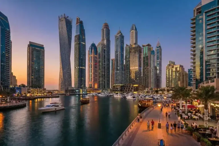
The canal is as much an urban-planning statement as it is an attraction. It was designed to relieve pressure on Dubai’s road network by giving Business Bay, Al Safa, and Jumeirah a car-free spine, to add usable public waterfront in a city where most coastline had been claimed by private developments, and to create a new address for hospitality, retail, and residential towers along its banks. In that sense, the canal functions similarly to how the Dubai Fountain anchors Downtown Dubai or how the Dubai Tram serves Dubai Marina – as infrastructure that doubles as a destination.
Where the Dubai Water Canal Is and How It Connects to Downtown Dubai
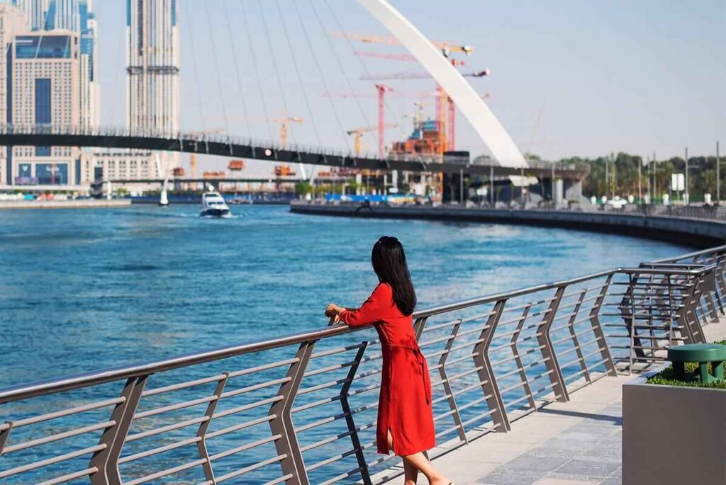
The canal begins near Business Bay, just south of Downtown Dubai, where it branches off from Dubai Creek. From there it runs beneath Sheikh Zayed Road, through Al Safa, past Jumeirah, and empties into the Arabian Gulf near Jumeirah Beach.
Because its starting point sits right at the edge of the Downtown Dubai and Business Bay districts, the canal is one of the easiest attractions in the city to combine with a Downtown itinerary. Visitors based near the Dubai Mall or Dubai Fountain can walk to the canal’s northern edge in well under fifteen minutes, making it a natural add-on to a Downtown or Business Bay day rather than a separate trip.
| Landmark | Approximate Distance from Canal Start |
|---|---|
| Burj Khalifa / Dubai Mall | ~1–1.5 km |
| Business Bay Metro Station | ~0.5 km |
| Dubai Fountain | ~1.5 km |
| Jumeirah Beach (canal mouth) | ~3 km downstream |
The Waterfront Promenade: Walking and Cycling the Canal
The canal’s defining public feature is its continuous waterfront promenade. The recreational banks offer a total of 6.4 kilometers of waterfront promenades and pathways, including a dedicated 3-kilometer running track and a 12-kilometer cycling path that loop around the surrounding neighborhoods. Paths are wide, well-lit, shaded increasingly by maturing trees, and separated into dedicated pedestrian and cycling lanes on both banks.
Walking the canal’s length and back, including crossing a few bridges, typically takes one to two hours at a relaxed pace, though most visitors break the walk up with cafe stops rather than doing it in one stretch. Cyclists can cover considerably more ground and often ride the full loop connecting the canal to nearby Safa Park.
Practical tips for walking or cycling the canal:
- Early morning (before 9 AM) and the two hours around sunset are the most comfortable times to walk, especially outside the cooler winter months.
- Footpaths are free and open to the public at all times; no ticket or booking is required simply to walk or cycle.
- Bike rental kiosks are available at several points along the route, with Dubai’s public bike-share system operating stations near Safa Park and Business Bay.
- Comfortable, closed footwear is worth packing – much of the walk is on paved promenade with limited shade in the middle of the day.
The Canal’s Bridges: Architecture, Names, and the Sheikh Zayed Road Waterfall
The canal’s bridges are its most photographed feature, and each was designed with a distinct architectural identity rather than as purely functional crossings.
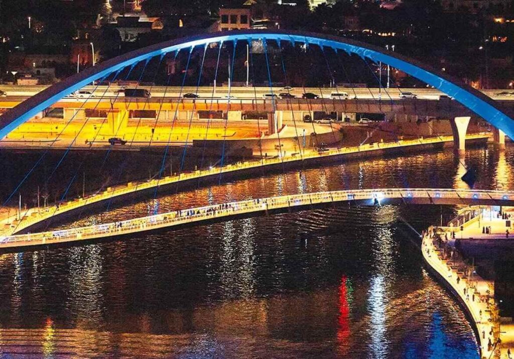
Five pedestrian bridges cross the canal, three of which connect one bank to the other, while two link Sheikh Zayed Road with Al Wasl Road and a third links Al Wasl Road with Jumeirah RoadOne bridge was purpose-built for cyclists, taking an arc shape as Dubai’s first suspended bridge of its kind, while another was renamed Tolerance Bridge in honor of the UAE’s Year of Tolerance. At night, several of the bridges are illuminated in shifting purple and blue lighting, adding to the canal’s reputation as one of the city’s better free evening photo spots.
The Sheikh Zayed Road Waterfall
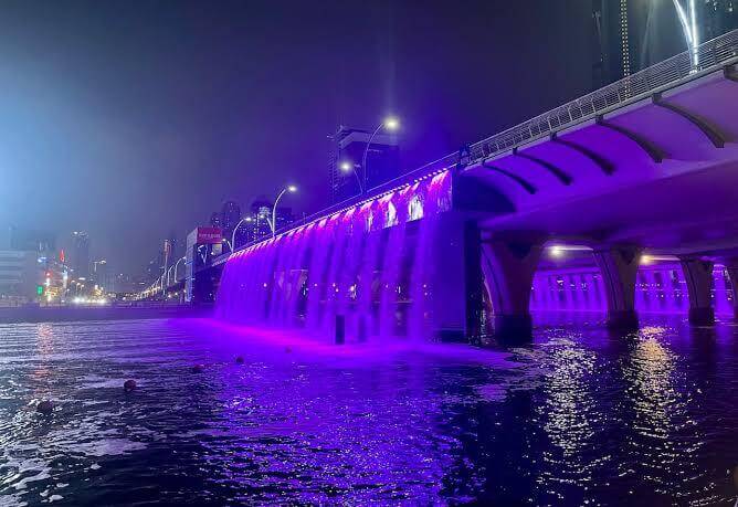
The single most talked-about feature along the entire canal is the artificial waterfall built into the underside of the Sheikh Zayed Road bridge. Rather than a small decorative fountain, it’s a full mechanical curtain of water that cascades from the bridge deck into the canal, lit at night in blue and purple tones that reflect across the surface of the water.
What makes the installation genuinely clever is its engineering: the waterfall is sensor-operated, and when a boat or water taxi approaches the bridge, sensors detect the vessel and the water curtain automatically parts to let it pass underneath before closing again once the boat has cleared. For many first-time visitors, catching the waterfall “open” for a passing boat is the highlight of a canal visit – though operating times can vary, so allowing extra time if this is a priority is worthwhile.
Boat Tours, Water Taxis, and Getting on the Water
Walking the banks only tells half the story – the canal is designed to be experienced from the water as much as from the promenade, and several distinct options exist depending on budget and purpose.
Types of Marine Transport Available
| Option | Best For | Character |
|---|---|---|
| RTA Water Taxi | On-demand, air-conditioned scenic rides | Modern, 10-seat capacity, bookable via app or station |
| Dubai Ferry | Longer scheduled sightseeing routes | Large vessel, Silver/Gold class seating |
| Private boat/yacht charter | Special occasions, larger groups | Operator-dependent, often bookable through hotels or tour platforms |
| Traditional abra | Short, low-cost hops on the Creek side | Open-air wooden boat, cash fare |
Dubai’s marine network is organized into three main hubs – the Creek, the Canal, and the Marina – with the Nol Card serving as the primary payment method across the Dubai Ferry, Water Bus, and Water Taxi services in 2026. RTA has positioned water taxis across two main zones, with Zone 2 specifically covering the area between the Dubai Water Canal and Dubai Creek, making it straightforward to combine a canal ride with a Creek crossing in the same trip.
Fares vary by route and vessel type rather than following a single flat rate. Marine transport fares across the network generally range from roughly AED 1 to AED 75 per person depending on the route, with scheduled water taxi and ferry routes toward the higher end and short abra crossings at the low end.
Editorial note: Marine transport fares, zone boundaries, and route schedules are updated periodically by the RTA. All prices in this section should be verified against the official RTA marine transport booking portal before publishing or before a visitor’s trip.
A Recommended Canal Route on the Water
One popular sightseeing route runs beneath the canal’s waterfall bridge, along Business Bay, and past the surrounding skyscrapers – effectively a floating version of the walking promenade, and arguably the best way to see the waterfall installation in action without waiting on the bank for a boat to pass.
Dining and Waterfront Lifestyle Along the Canal
Restaurants and cafes have clustered densely along both banks of the canal, particularly in the stretch closest to Business Bay and Al Safa, where several hotel towers anchor ground-floor dining terraces facing the water. The mix ranges from casual coffee shops and juice bars aimed at joggers and cyclists to sit-down restaurants and rooftop lounges positioned for sunset and skyline views.
Rather than being concentrated in one retail block the way Dubai Mall or BurJuman are, canal dining is spread out along the walk, which suits visitors who want to combine a stroll with several shorter stops rather than a single destination meal. Waterfront hotel terraces near the JW Marriott Marquis area of Business Bay are a particularly popular cluster for evening drinks with a canal view.
Best Times to Visit the Dubai Water Canal
| Time of Day | Experience |
|---|---|
| Early morning (7–9 AM) | Cooler temperatures, quiet paths, good for running or cycling |
| Midday | Warmest and least comfortable outdoors, best used for indoor stops nearby |
| Late afternoon to sunset | Golden-hour skyline views, busiest photography window |
| Evening (post-sunset) | Bridge and waterfall lighting, liveliest dining atmosphere |
Seasonally, the cooler months from November through April are the most comfortable for walking or cycling the full promenade, while summer visits are best planned around early morning or after dark, with midday stops shifted indoors to nearby malls or hotel lobbies.
Common Mistakes Visitors Make at the Canal
- Treating it as a single stop instead of a corridor. Because the canal has no single “entrance,” visitors sometimes see only one short stretch and miss the bridges, waterfall, or dining clusters further along.
- Expecting to swim. Swimming is not permitted in the canal, since it functions as an active marine traffic corridor for water taxis, ferries, and private boats; nearby Jumeirah Beach or a hotel pool are the correct alternatives.
- Visiting midday in summer without a plan for heat. The promenade offers limited shade in stretches, and a midday walk in July or August can be genuinely uncomfortable without breaks.
- Assuming all marine transport is the same price and route. Water taxis, ferries, and abras operate on separate networks with separate fares – confirming the specific route and vessel type before booking avoids confusion at the station.
- Missing the waterfall’s operating pattern. Since the Sheikh Zayed Road waterfall responds to passing boats, visitors expecting a constant cascade sometimes leave disappointed; timing a visit around boat traffic (or riding a water taxi through it) improves the odds of seeing it in motion.
Comparing the Dubai Water Canal to Dubai’s Other Waterfronts
| Feature | Dubai Water Canal | Dubai Marina | Dubai Creek |
|---|---|---|---|
| Character | Modern engineered canal through central districts | Purpose-built marina district with high-rise towers | Historic natural inlet, traditional trade route |
| Best for | Walking, cycling, mid-city scenery | Nightlife, dining, yacht culture | Heritage, abra crossings, souks |
| Free public access | Yes, full promenade | Yes, Marina Walk | Yes, waterfront and souk areas |
| Signature feature | Sensor-activated waterfall bridge | Skyline and yacht views | Traditional wooden abras |
Future Outlook
As Downtown Dubai and Business Bay continue to densify with new residential and hospitality towers, the canal’s waterfront is likely to see further dining, retail, and public-realm investment over the coming years, consistent with the pattern already seen since its 2016 opening. Expansion of RTA’s digital booking and marine station network is also part of the authority’s stated direction for 2026, which should make combining canal walks with on-water routes increasingly seamless for visitors.
Conclusion
The Dubai Water Canal is best understood not as a single attraction but as connective tissue between some of Dubai’s most visited districts – a free, walkable, and increasingly green corridor that links Business Bay’s skyline to Downtown Dubai on one end and the Jumeirah coastline on the other. Whether the goal is a quiet morning run, a sunset walk past the illuminated bridges, or a short water taxi ride beneath the Sheikh Zayed Road waterfall, the canal rewards visitors willing to treat it as a place to wander rather than a box to tick.
FAQs
1. What is the Dubai Water Canal?
It’s a 3-kilometer man-made waterway that extends Dubai Creek through Business Bay, Al Safa, and Jumeirah out to the Arabian Gulf, opened to the public in 2016.
2. Is the Dubai Water Canal free to visit?
Yes. The walking and cycling promenades along the canal are free and open to the public at all times; costs only apply to optional boat tours, water taxis, or dining.
3. Can you swim in the Dubai Water Canal?
No. Swimming is not permitted because the canal is an active marine traffic route for boats and water taxis; nearby beaches or hotel pools are the recommended alternative.
4. How long is the walk along the Dubai Water Canal?
The full waterfront network includes roughly 6.4 km of promenade, with a dedicated 3 km running track and 12 km of cycling paths; walking the canal’s length and back typically takes one to two hours.
5. What is the waterfall at the Dubai Water Canal?
It’s a sensor-activated water curtain built into the underside of the Sheikh Zayed Road bridge, which parts automatically to let boats pass beneath it and is illuminated at night.
6. How many bridges cross the Dubai Water Canal?
There are five pedestrian bridges along the canal, including one built specifically for cyclists and one named Tolerance Bridge.
7. How do you get to the Dubai Water Canal from Downtown Dubai?
The canal’s starting point near Business Bay is roughly a 15-minute walk from the Dubai Mall and Dubai Fountain, making it easy to combine with a Downtown Dubai visit.
8. Can you take a boat tour on the Dubai Water Canal?
Yes. RTA water taxis, private charters, and select ferry routes operate along the canal, with popular routes passing under the waterfall bridge and along Business Bay.
9. What is the best time to visit the Dubai Water Canal?
Early morning or the hour around sunset offer the most comfortable temperatures and the best light for photography; evenings add illuminated bridges and a livelier dining scene.
10. Is the Dubai Water Canal good for cycling?
Yes, the canal has a dedicated 12 km cycling path with rental kiosks available at several points along the route.
11. How much does a water taxi cost on the Dubai Water Canal?
Fares vary by route and vessel type, generally ranging from a few dirhams for short abra-style crossings to higher fares for scheduled water taxi and ferry routes; current pricing should be checked on the official RTA marine transport site.
12. Is the Dubai Water Canal connected to Dubai Creek?
Yes. The canal was specifically built to reconnect Dubai Creek to the Arabian Gulf, restoring a continuous water route that hadn’t existed since the mid-20th century.

Shahzeen Usman is a full-time content writer based in the UAE, with over 5 years of local experience covering travel, lifestyle, and destination-focused stories. She specializes in creating engaging, research-driven content that highlights hidden gems, cultural insights, and travel trends across the Emirates and beyond.
With a deep understanding of UAE tourism, Shahzeen brings authentic perspectives to her writing, helping readers discover meaningful travel experiences. Her work combines storytelling with SEO best practices, making her content both informative and search-engine friendly.